The Long, Dark Night
Reposted from my December 2022 newsletter, edited for this platform.
Have you ever paid careful attention to the winter solstice in your region... how short the day feels and how long the night feels? Where the sun rises and sets in your winter landscape?
If you have given this seasonal event intentional observation, you probably know the terms "civil twilight", "solar noon", or "meridian". These terms, and many more, describe specific steps in the process of the earth's daily rotation on its axis as well as its orbit around the sun.
My first winter in Alaska was spent in total wonder with the changing light; chasing the sun to see where it disappears, reappears, and how it shapes everything we see.
Because I was still getting my bearings on the landscape, my efforts were somewhat random and scattered, albeit fun and interesting.
This year was different...intentional, engaged, methodical.
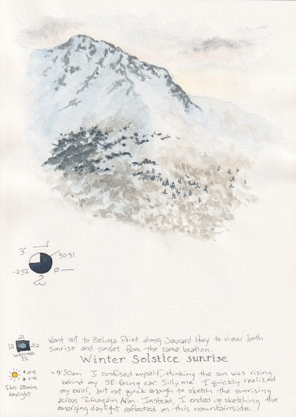
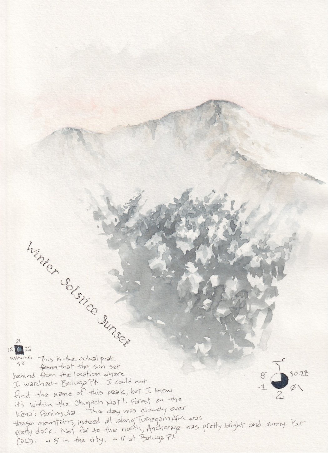
Beluga Point, a popular viewing spot for Beluga whales along Turnagain Arm, offers views of sunrise and sunset. I parked myself there excited to witness and document the full winter solstice at latitude 61.
The day was filled with a mix of shifting altocumulus and cirrostratus clouds. I never actually saw the sun's orb, not because of the clouds but because of my location in proximity to the mountains... the sun does not rise above most of the summits here during winter. Still, the light bathed the peaks and clouds in extraordinary soft colors.
My curiosity about the winter solstice in an extreme northerly location led me to explore the process, thus the terms mentioned.
Meridian is the continuous longitudinal path around the globe, connecting the north and south poles. Solar noon is the moment the sun crosses the meridian due south of a geographical location.
Civil twilight is when the geometric center of the sun is exactly 6º below the horizon, the period of time when the darker gray-blues of night mingle with all the beautiful colors as the earth turns away from or towards the sun.
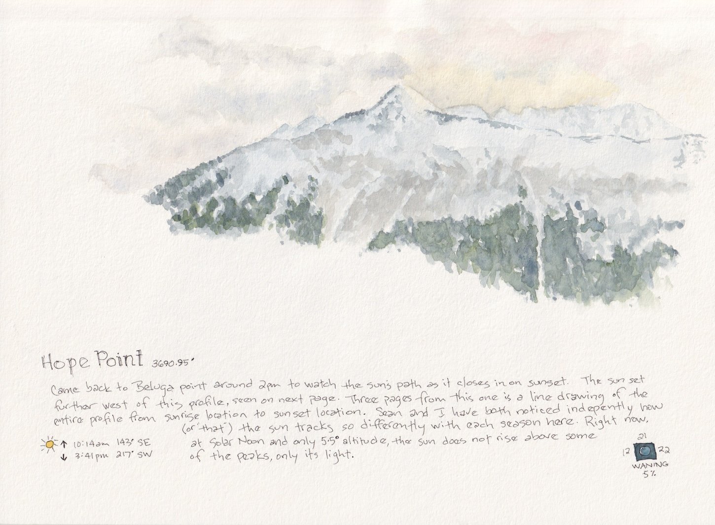
My journal pages include notes about times of sunrise and sunset and their compass location. Sunrise was 143º SE, sunset was 217º SW.
But what's the distance between these two locations?
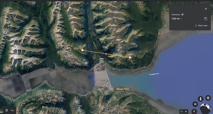
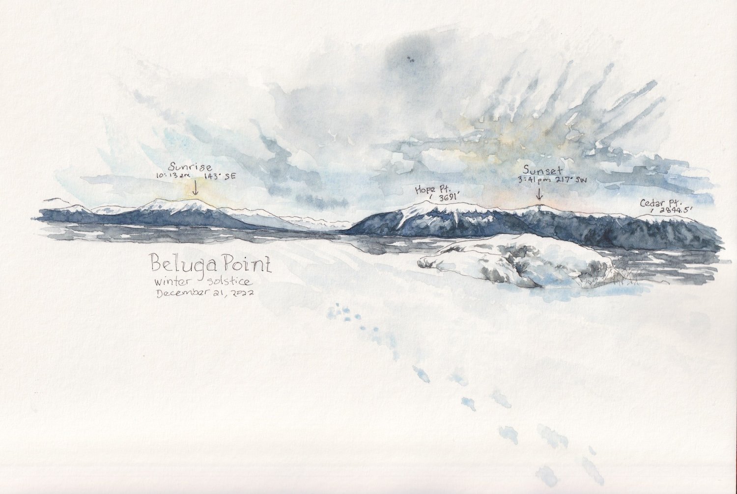
I used Google Earth to identify which peaks in the landscape the sun rose and set behind. At Beluga Point, it's approximately 7.5 miles.
Another question. If the sun's position at solar noon was 6º above the horizon, can that convert to something my brain can make sense of? Feet? Or maybe it's miles? Either one I can understand.
Sadly, it involves trigonometry, something not in my toolbox. With a little help I learned the horizon at sea level is 3.1 miles away and 6º above that is about 0.3 miles, or 1584 feet. That's low!

The winter solstice is a festive occasion in Alaska, as it is in many far north regions because it represents a return to light. Personally, I was very relieved and happy to reach this point!
The shift back to the light is slow in the beginning, measured in seconds per day for the first few days. In the nine days since the solstice, Anchorage has gained one minute forty-two seconds of daylight.
Eventually, that daily addition of light speeds up to between five and six minutes per day, until the summer solstice arrives and gives us more than nineteen hours of daylight, an extreme with its own challenges.
This being my second winter in Alaska, I cannot say that I've adapted to the long dark of winter but I count myself lucky to have experienced all of it. :)